Innovation in water management: Urnieta and Geograma create a 3D inventory of water supply and sanitation networks
In November 2024, the Urnieta town hall entrusted Geograma, our Spanish partner, with the study and digitization of the supply and sanitation network, a project financed by the urban water cycle order PERTE TED/934/2022 (“Recovery, Transformation and Resilience Plan. Funded by the European Union-Next Generation-EU”).
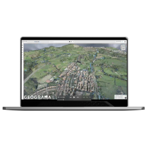
The importance of levels and elevations in these inventories led Geograma, within the framework of the project, to use Mobile Mapping as a 3D capture technique and to provide the Urnieta town hall with a tool enabling it to consult 3D information on Urnieta using the GeoCassini .
Geograma combined the municipality's LiDAR flight with the Mobile Mapping survey of the city's streets , work that was carried out specifically for this project.
This tool not only provides Geograma technicians with the basic information needed to inventory networks in situ , but also allows technicians from the Urnieta town hall to conduct inspections, audits, and measurements in any part of the municipality. It also enables them to combine this information with future BIM models for projects commissioned by the administration.
In addition, this information will also be part of the 3D database of the Department of Mobility, Tourism and Territorial Planning of the Diputación Foral de Gipuzkoa, which uses the same platform.

